
![]()
Regional Vegetation and Land Monitoring for Climate Adaptation
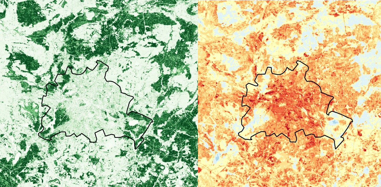
Municipalities have a responsibility to integrate climate adaptation measures into urban development concepts and planning. The tool utilizes satellite data to capture nationwide relevant parameters for climate adaptation providing planning assistance. The aim is to create a nationally standardised information and decision-making basis for municipal planning instruments such as the landscape plan, land use plan or development plans, as well as for the development of urban planning concepts and urban development plans.
An annually updated cloud-based data portal offers indicators on thermal stress and relief as well as hydrological relief, which can also be used for further processing in geographic information systems (GIS).
Integration into the services:
Green Spaces Sealing Heat Stress